My top priority at Lake Baikal was hiking the Great Baikal Trail from Listvyanka to Bolshiye Koty. And on my first full day at the lake, I did. Well, sort of.
When I was putting together my itinerary for three weeks on the Trans-Siberian Railway, spending time in nature was a high priority. I’d been to Russia four times before but somehow never spent any time exploring the country’s vast forests or endless countryside.
Visiting Listvyanka on Lake Baikal for me was all about experiencing a different side of Russia: one of peace and tranquillity and getting to grips with what I really imagined when I thought of Siberia: lush, green, wild nature.
For more on what to see and in Listvyanka: Visiting Listvyanka in the off-season

Happy hiking selfie on the Great Baikal Trail
Hiking the Great Baikal Trail in May
But there was a flaw in my planning. I came a bit too early. My original plan was to hike from Listvyanka to Bolshiye Koty in one day, before catching the last boat back to Listvyanka in the evening. However, the scheduled boat service from VRSP only started on 1 June. I was in Listvyanka 26-28 May. Literally four days too soon.
So instead, I resolved to walk half-way there and half-way back.
Of course, that isn’t the only option; several couples I met en-route walked to Bolshiye Koty, stayed there overnight and then hiked back to Listvyanka the next day.
Hiking (halfway) from Listvyanka to Bolshiye Koty
The Great Baikal Trail begins at the end of ul. Gudina (Gudina street). From the shoreline of Lake Baikal, there’s about 1.6km of walking until you get to this point, where the road turn into a dirt track and you see a small camping area and the first signpost for the Great Baikal Trail.
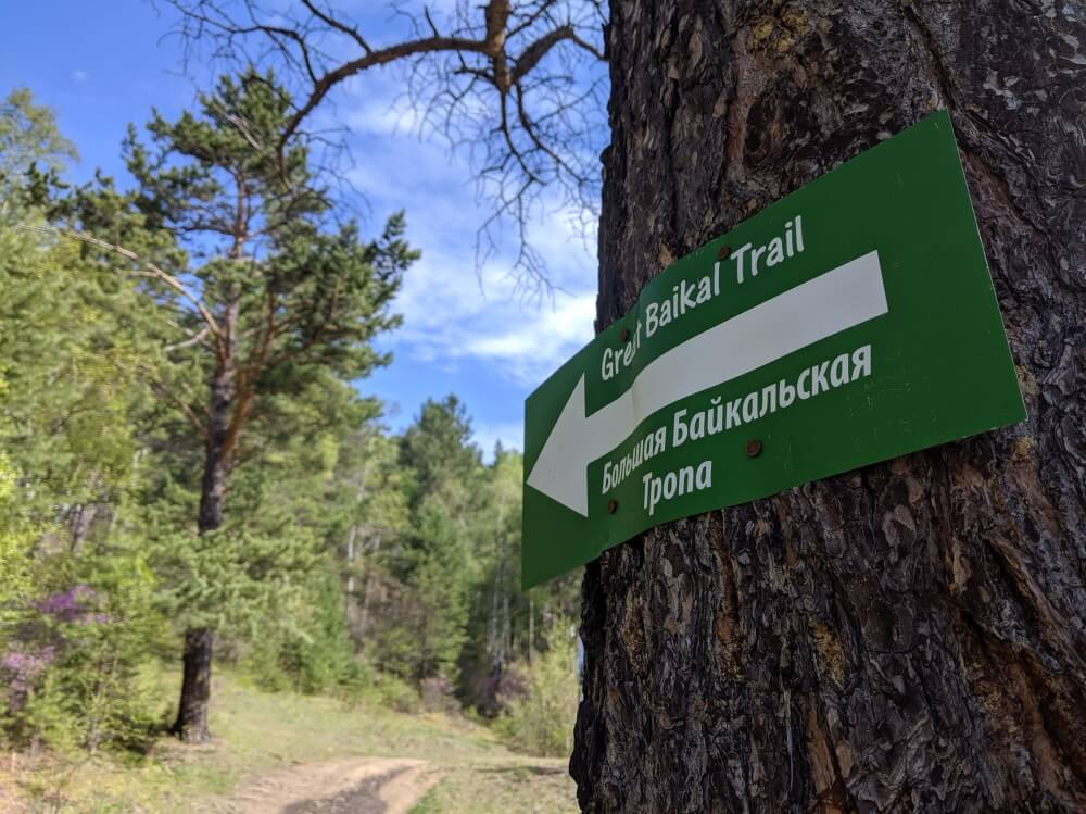
The start of the trail in Listvyanka
Paying entry in the National Park: there was literally no way of doing this when I arrived. I asked at the hostel, who simply told me at the time of year of my visit (May) there wouldn’t be anyone to collect a fee. I did walk past a small mobile hut that was clearly meant to be for checking tickets but it was closed.
The Great Baikal Trail: heading uphill
The route starts off with a gentle incline from here. You’re far from the shoreline at this point and won’t see the lake again until you reach the crest of the hill that you’re about to start climbing. On my hike, the woods were a buzz – quite literally – with the sights and sounds of life; chipmunks scurrying along the ground, butterflies and flies in equal measure and a really puzzling amount of gigantic ants’ nests. (I am really not a fan of ants and their giant hive nests really freak me out. If, like me, you find ants a bit creepy, be warned there are a lot of these nests. Be brave.)
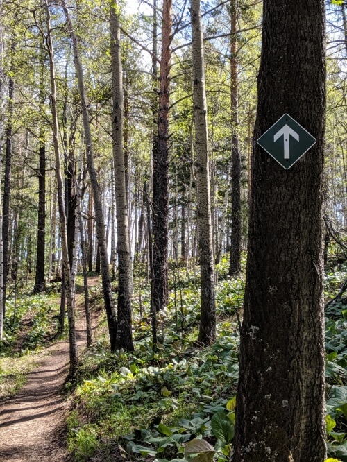
After a short while in the trees, the trail really takes it up a knotch and you are faced with a very long slog of uphill trekking, in one straight line. This wasn’t the most fun part, but the satisfaction at the top is worth it. Don’t be afraid to take your time here – I like to take hills very quickly and was berating myself for slowing my pace right down. It wasn’t til I came back the same way that I appreciated just how steep this stretch of the trail was. This is by far the hardest stretch of the route.
On reaching the top, you are still in thick woodland and have a little while before you crest the hill and see the clear waters of Lake Baikal again. The route here meanders gently through some trees and is equally well sign-posted.
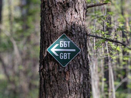
Is the Great Baikal Trail sign-posted? Yes, really well. You’ll recognised the while arrow head on a teal green sign. Markets might also include GBT or ББТ to mean Great Baikal Trail. No knowledge of Russian is necessary, but if you see ТРОПА НЕТ, then don’t walk any further. It equates “No through way.”
Hiking Listvyanka to Bolshiye Koty: reaching the top
After another short incline, you’ll reach the crest of the hill and see the blue waters of Lake Baikal and the mountains beyond. You’ll notice that you are still some way from the waters’ edge, though. Here you can appreciate just how hilly and mountainous the terrain is in this region. Between you and the lake is a very steep, thickly-wooded drop.
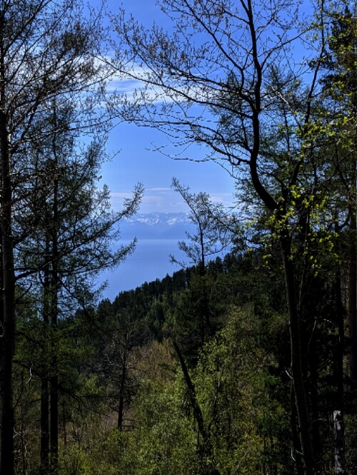
View from the crest of the hill
From here, the routes takes a left and navigates you up another slight incline (with picnic table), before a series of short, steep drops. You’ll then begin a series of 10 switch-backs, which will take you all the way down to the level to the water level. It’s actually surprising how quickly you descend without noticing.
At this point, I was beginning to fret a bit – looking back up at the mountain as you descend makes it feel like a mighty behemoth that you are going to have to tackle on your way back. But as is the nature of switchbacks, you can manage to scale it pretty quickly without any kind of superhuman effort. The steep incline at the beginning is much more formidable.
Is the hike from Listvyanka to Bolshiye Koty difficult? From my experience, I would say no. That’s not to say that parts aren’t tiring, but I would say only the one steep section near the beginning is really challenging. If your basic fitness level is low or very low, it will be a very hard start, but I think the hike would be doable for the majority of people.
From this point, it’s a fairly flat walk through some tall forest-floor growth. It was pretty humid at this point in my hike, so be prepared to sweat! After around 1.5km, you’ll reach the pebbly shore of the lake. If you’re lucky like me, you might get this view all to yourself.
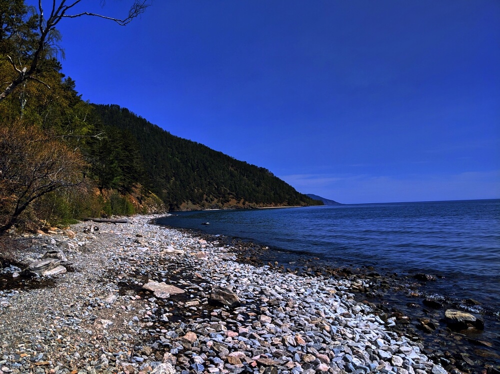
The shoreline on reaching Lake Baikal again
And what a view it is; standing on the shore, the only thing you can see is the water stretching out in front of you, and the narrow grey pebble beach clinging to the steep green mountains behind you. The water is insanely clear. It really felt like true wilderness. A real piece of Siberia. It was just beautiful.
There are a few picnic benches there and it makes the perfect place to stop for lunch and gaze out at the open water. I met a French couple here who had spent the night in Bolshiye Koty having done the hike there the day before. They told me from this point onwards towards the village, the path is fairly straight-forward. And they weren’t wrong.
Food and water on the Great Baikal Trail: when hiking, make sure to take food with you as there is none available en-route. For water, you can fill up your bottles directly from the lake. It really is clean enough to drink from directly.
Hiking along the shore of Lake Baikal
After a nice long leisurely lunch, I headed on along the path, which climbs gradually higher, leading you along the coastline but high above the water on a steep cliff edge. From here, you have fantastic views across the water as the path clings to the side of the hill and winds around edges. There are some great benches dotted around so you can enjoy the views.
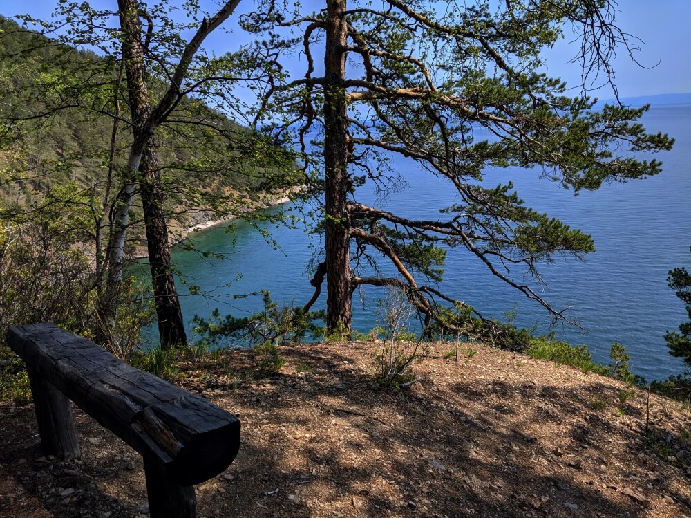
A great bench. Top placement.
After a while, another narrow beach (this time sandy) came into view after a small inlet. I headed straight for it, where I had the entire sandy strip all to myself. The sun was shining, the sand warmed my feat and I enjoyed the peace and solitude. I still can’t believe how lucky I was to be enjoying such a view all my myself. One boat passed in the distance in fifteen minutes. One. It really was everything I was hoping for when I thought of getting out into the Siberian woodlands and seeing more of Lake Baikal than just Listvyanka.
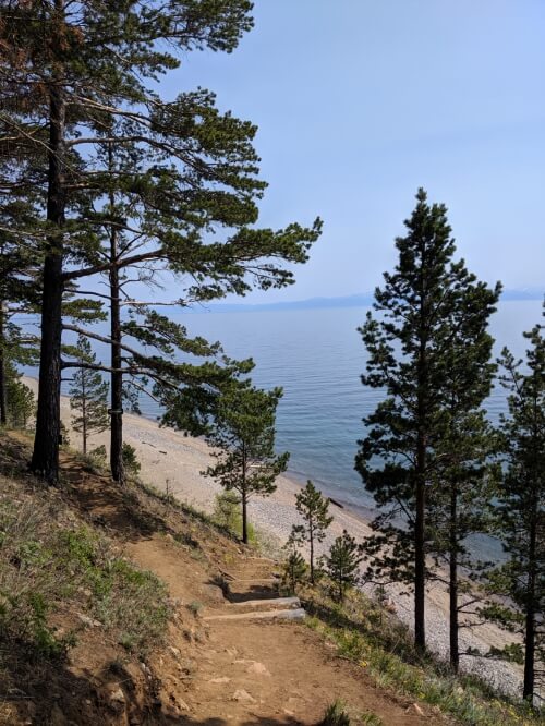
My own private beach
From here, I headed back to Listvyanka, clocking up a total of 23.5km.
Some more photos of the Great Baikal Trail
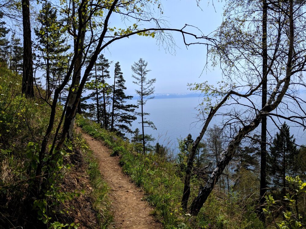
The ‘classic’ view
After conquering the giant hill, the rest of the trail to Bolshiye Koty looks similar to this – a winding hiking route with beautiful views of the water. On a clear day you’ll be able to make out the mountains on the far eastern side.
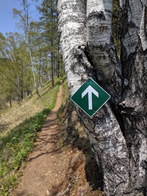
The trail is well signposted
These green markers will lead the way along the route, but it is a very nice, easy trail with very few opportunities to get lost.
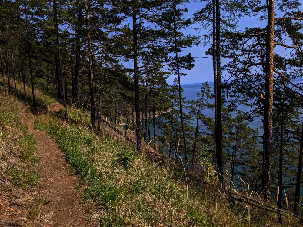
First view of my private beach
The edge of the lake is dotted with narrow strips of sand or stone, like this one, making tiny little beaches – the ideal place to stop and relax.
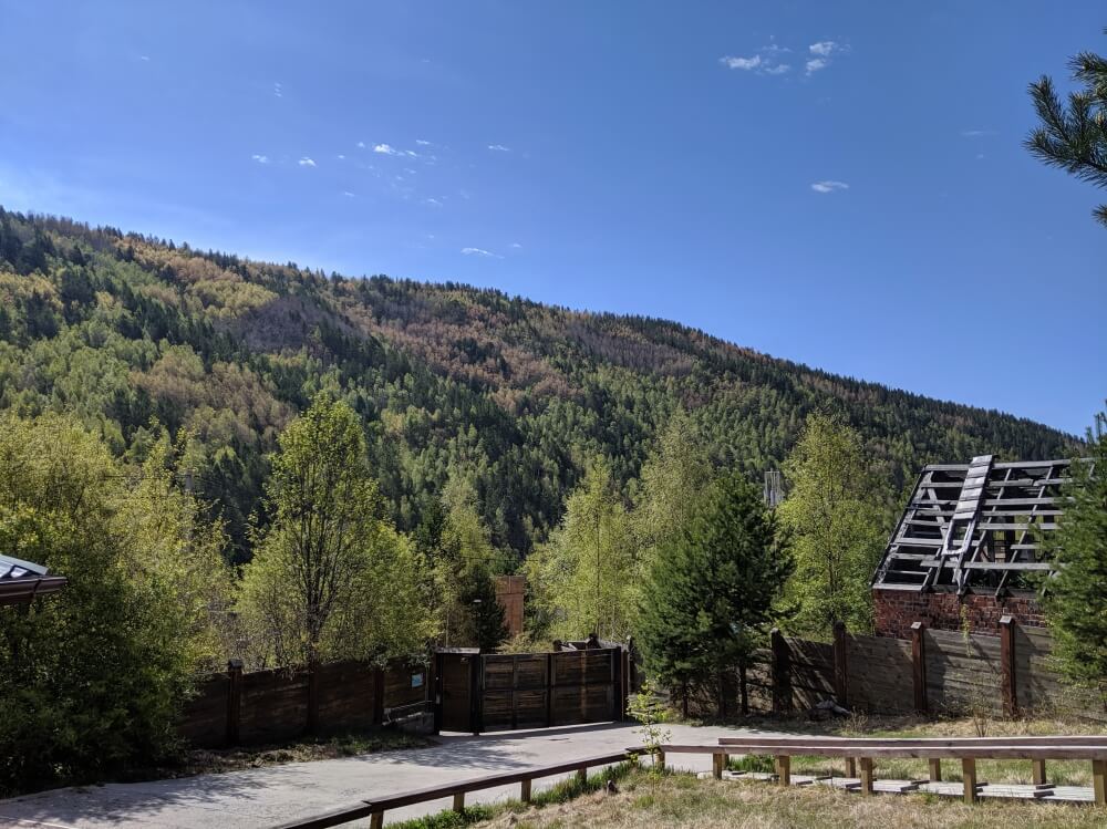
View from Belka Hostel in the early morning
This is the view from my hostel (Belka Hostel) on the morning of starting the hike. The initial walk along ul. Gudina looks similar – a low-lying street in the middle of a small valley.
Top tips for hiking the Great Baikal Trail
- Download MAPS.ME app before heading out – it actually has the route of the Great Baikal Trail marked (although it also has some additional trails leading off the main route, which are definitely not proper tracks, so still pay close attention to signs)
- Do what you can to pay the entrance to the National Park. Ask at your accommodation and maybe the tourist office.
- Check boat times before you get to Listvyanka.
- Keep to the marked paths. The Great Baikal Trail runs through a national park and nature reserve. Be respectful and take all your litter home with you.
- Take a torch, just in case.
- If you want to do this trail as an organised tour from Irkutsk, check out this 2 days/ 1 night hiking tour from Baikaler
More on the Trans-Siberian:
Heading West:
Krasnoyarsk:
6 reasons to visit Krasnoyarsk
Hiking in Stolby Nature Reserve
Heading East:
23 hours in Ulan-Ude
Why you should add Vladivostok to your Trans-Siberian itinerary


Very interesting read, John! I would love to experience the Lake and do the hike, but I do wonder… Are there any bears in the area? Please advice
Thanks Annette. I don’t think there are many (or any bears) so close to the village of Listvyanka but I am sure there would be some further north! I have some bear-related news coming up in the next posts…
That is a LONG trek, but the views are fantastic!
The views were fantastic! And luckily, the hike didn’t feel too long. Would have loved to have done more!
Someday, if you will visit Finnish Lapland, there are many routes. We love only day hikes. When hiking far beyond the Arctic Circle, you meet free roaming reindeers! Here is my first post about the series of posts showing our day hikes.
North of the Arctic Circle 3
Happy and safe travels!
The scenery in Lapland looks beautiful, Sartenada! Thanks for sharing.
I did the trek organized thru Baikaler, went partly by boat, stayed the night at Bolshie Koty, walked back the full trek next day to Listviyanka. Had a wonderfull guide Valerio, exremly knowledgeable and helpful. With him around there was nothing to worry about.
Thanks for sharing, Subir! What time of year was this?