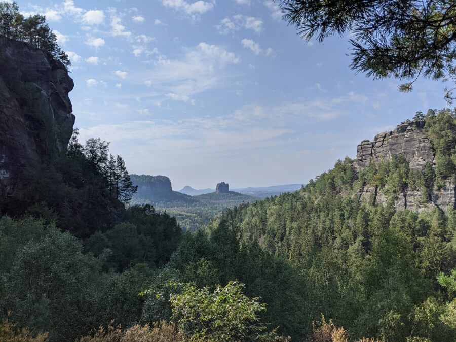
Saxon Switzerland (or the Sächsische Schweiz) is probably one of the most beautiful, dramatic and least well-known landscapes in Germany. Snuggled up along the border with the Czech Republic, this corner of Germany is well-worth exploring – and is easy to reach from Dresden, its closest big urban centre.
I’ve hardly made a secret of my love for Saxony and its capital Dresden (in fact, I’ve been down-right vocal about it) and Saxon Switzerland is a big part of the draw – its proximity makes it a perfect destination for a day trip from Dresden, which is always how I have visited the region.
Below is a a summary of the landmarks of this corner of Germany, as well as some of the things to see and do here – including hiking in Saxon Switzerland. This is based on my trips here in Summer 2011, March 2019 and September 2020.
About Saxon Switzerland
What is Saxon Switzerland?
Saxon Switzerland is an area of Saxony known for its sandstone mountains and abrupt stone pillars and rock formations along the River Elbe, which cuts through the region in a deep valley. Despite its name, the area is far less mountainous than Switzerland but was nevertheless given its current name by two Swiss students in 1766 who enjoyed hiking in Saxon Switzerland. Today around one third of the total region is a national park.
Away from the mountains, the area is characterised by small villages along the river, a large abundance of hikers, climbers and campers and is known for its sweeping panoramas of its various mountain tops. On the other side of the border, you’ll find Bohemian Switzerland.
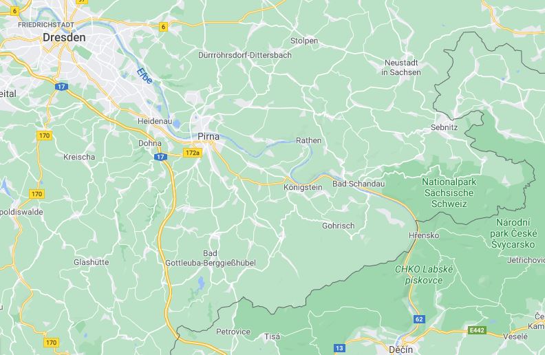
The area along the Elbe from Pirna to the Czech border is generally considered to be Saxon Switzerland
History of Saxon Switzerland
Despite not being very well known outside of Germany (or ‘criminally overlooked,’ as I would say), tourism first boomed in the area in 1800s. In fact, the region claims to be home to the world’s oldest tourist attraction, as the Basteibrücke serves no practical purpose and was built purely for tourists.
The area is also synonymous with famous German painters like Casper David Friedrich and Ludwig Richter who were drawn (geddit…?) to the region’s beautiful landscapes. Today the region’s premier hiking route is called the Malerweg or ‘Painter’s Way.’
Landmarks of Saxon Switzerland
The region has a handful of popular sights and landmarks which are easily visited.
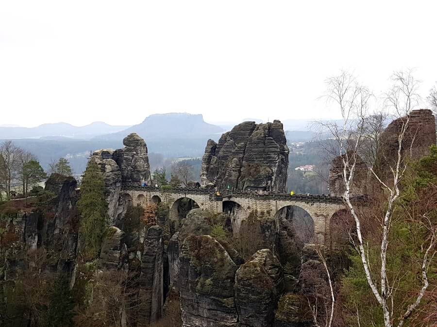
The Basteibrücke (taken in grey weather in March 2019)
The Basteibrücke
If you Google ‘Saxon Switzerland,’ I guarantee the first image to appear will be of this bridge, the unofficial symbol of the area. In reality, the bridge is… just a bridge, but the formation it was built upon (the Bastei) is a series of towering rock pillars, which rise imposingly from the banks of the Elbe below. The Bastei has been a tourist draw for over 200 years and was mentioned in travel literature for the first time in 1797. On his visit, Goethe (Germany’s Shakespeare) reportedly said, “…the eye takes in a sweeping view that can never be described in words.”
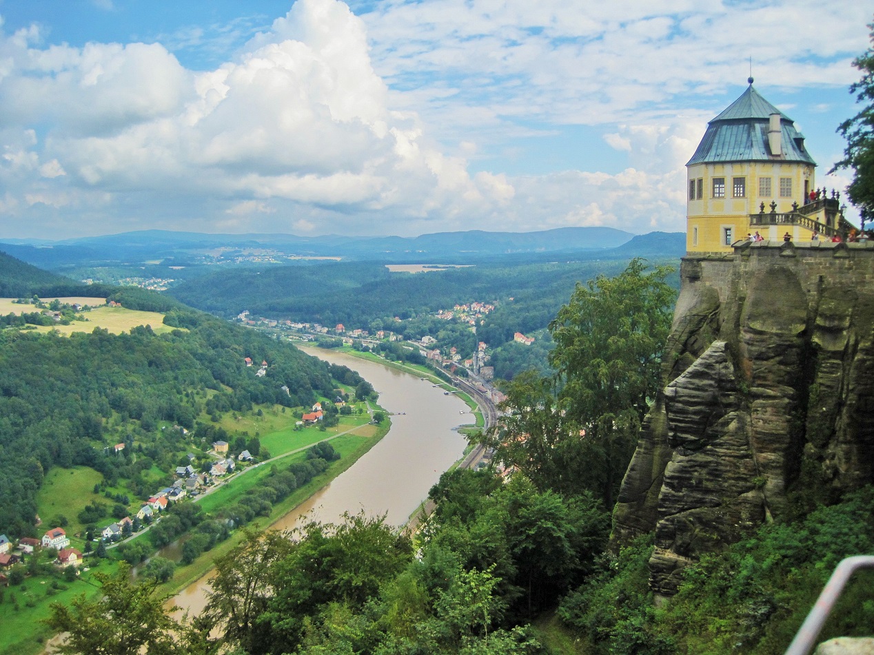
View of the Elbe from Königstein Fortress (taken on a sunny day in Summer 2011)
Festung Königstein
Another site synonymous with Saxon Switzerland is the Königstein fortress, the largest fortress in Germany and one of the largest in Europe. Apparently known as the ‘Saxon Bastille’ (thanks Wikipedia…), the fortress was never conquered in its 400-year history and so served as both a safe retreat for the Saxon monarchs as well as an infamous state prison. The gigantic fortress is largest just around the corner (or the river bend) from the Bastei, in the town of Königstein.
The intimidating structure can be seen from miles around and is well-worth visiting. If you go, you’ll be treated to fantastic views from the edge of the ramparts, as well as a glimpse at the second-deepest well in Europe. (Thanks again, Wikipedia!)
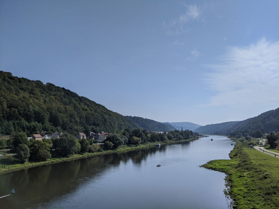
View of Bad Schandau from the Elbe
Bad Schandau
If you come to this corner of Germany, there is a high chance you will pass through the pretty little village of Bad Schandau, which serves as sort of unofficial capital of the area. The seemingly sleepy little town is home to a sprawling wellness hotel (Kurhotel) where Germans visit to boost their health. The town is small but pretty and is home to the Kirnitzschtalbahn (or Kirnitzsch valley railway), a 122-year-old heritage tramway which runs through the national park to a criminally underwhelming waterfall. Be warned: the Bad Schandau train station is weirdly far away from the town centre.
Things to see and do in Saxon Switzerland
Hiking in Saxon Switzerland
It will come as no surprise to anyone to reveal that my favourite thing to do in Saxon Switzerland is to hike. (It also helps that hiking in Saxon Switzerland is the easiest and most popular activity.)
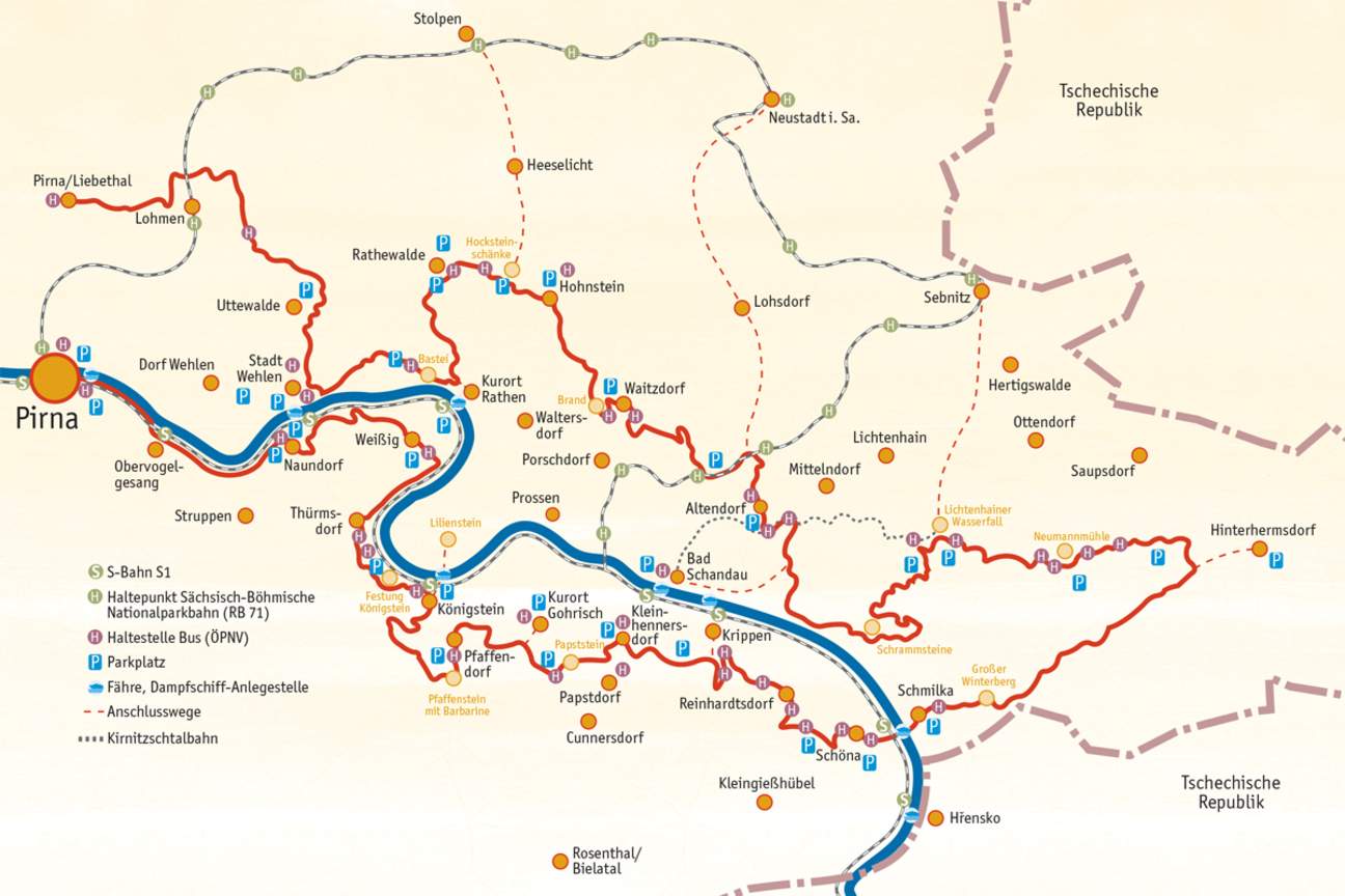
The full route of the Malerweg
The area is home to plenty of hiking trails and routes but the one I know the best (i.e. have hiked two sections of) is the Malerweg, the region’s premier trail. The Malerweg (lit: Painter’s Way) is an eight-stage hiking route which covers both sides of the Elbe river and passes through some of the area’s most scenic areas.
To date (Autumn 2020), I’ve walked section 2 and section 4.
Hiking to the Basteibrücke and Hohnstein: Malerweg Stage 2
Starting from the train station in Stadt Wehlen, the first thing you do is take a little ferry across the river to the other side – here’s where the hike starts. (I really like these river ferries and it amazes me how many people in Germany are still dependent on them.) Pretty soon after alighting the ferry, you start heading upwards – and not in some small, gradual sort of way – this is quite the climb.
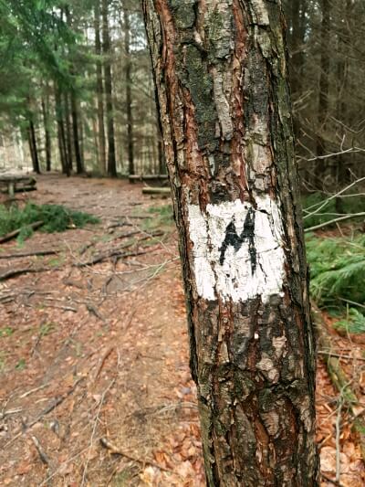
The markings for the Malerweg route
After around 2.5 kilometres (and at least one look-out point with great views of the Elbe), the terrain levels out and you continue through some woodland before reaching the Basteibrücke.
From here, the official Malerweg route takes you down into the spa town of Rathen on the northern side of the river. However, this route completely bypasses the Schwedenlöcher (lit: Sweden holes), which I would definitely recommend.
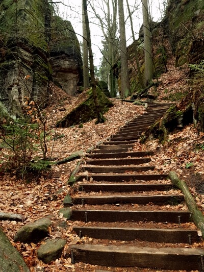
Going via the Schwedenlöcher means a lot of steps
The Schwedenlöcher are essentially a series of huge rocks that you walk between via a narrow and often steep path. The route itself is not too taxing coming down (I would strongly recommend going down this path and not up), but there are a couple of narrow staircases which made me (with a huge fear of heights) feel slightly nervous. It’s well worth it though in my opinion, as you quickly lose the groups of crowds clustered around the Bastei and find yourself walking between giant boulders and feeling like you have suddenly entered Middle Earth (or Narnia, depending on your persuasion). Take your time going down and soak up the scenery – you may also have to pause for some very sweaty hikers making their way up.
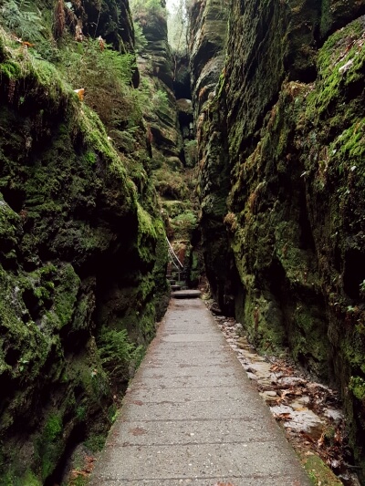
The route passes through some narrow channels
At the end of this trail, you will re-join the official Malerweg route. Here you can opt to back-track into Rathen or simply carry on towards Hohnstein. I opted for the latter, though there is a small boating lake closeby which might be nice to visit for summer hikes.
The route then takes you up through a narrow little valley with a few old watermills and through the village of Rathewalde before heading towards Hohnstein.
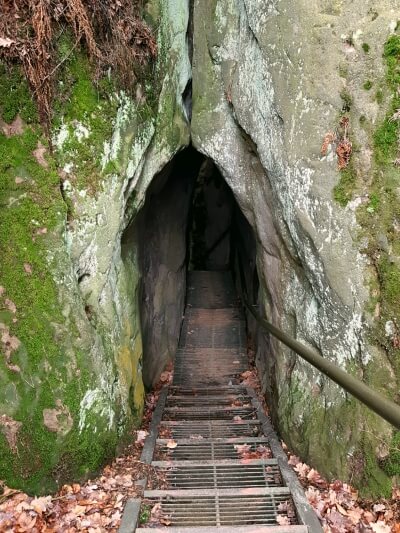
Heading down through the Hackstein
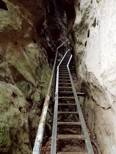
Just before reaching Hohnstein, you’ll encounter Hockstein. Hockstein (or possibly ‘The Hockstein’…?) is a towering free-standing sandstone column, which looks out at the town of Hohnstein from across the deep Polenz valley (Polenztal). Following the Malerweg route, you’ll reach the rock from the top, be treated to some impressive (and also nerve-wrecking and dizzying) views, before descending a complicated network of steps and ladders down around and often through the sandstone rock to reach the bottom of the valley. It felt quite death-defying but in reality, there wasn’t any real danger, just nervousness.
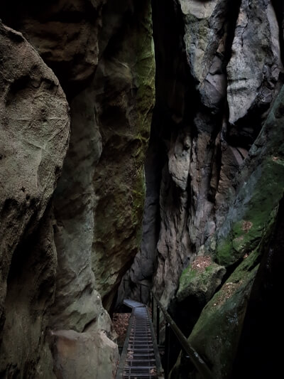
Can you spot the ladder? It really was that steep…
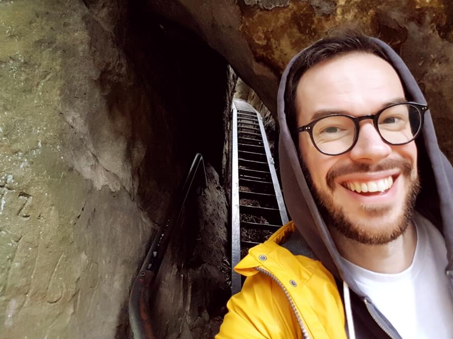
Selfie after defeating the Hackstein!
After that, it’s a fairly simple walk back up the valley on the otherside to the pretty little town of Hohnstein, where a bus (the 237 Wanderbus – see How to Get to Saxon Switzerland) goes every two hours to Pirna train station, where you can catch a connection to Dresden.
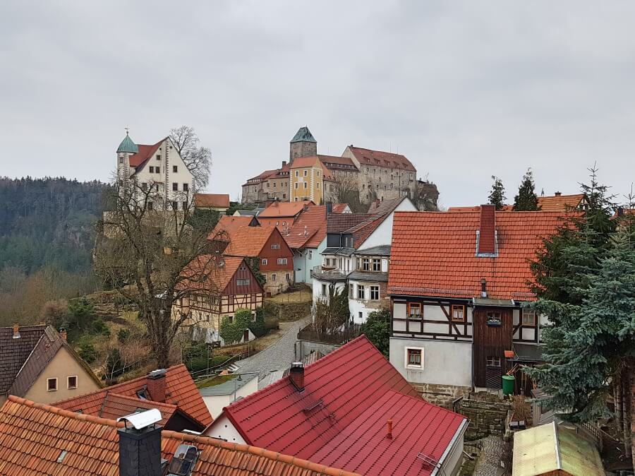
Hohnstein – the end point of the second stage of the Malerweg
Did you know? The Grand Budapest Hotel was filmed closeby in Görlitz and Saxon Switzerland was the inspiration for many of Wes Anderson’s set designs. Read more here.
Around Bad Schandau: Malerweg Stage 4
Stage 4 of the Malerweg is probably the most beautiful hike I’ve done in Germany. The views were incredible. (Granted, it was a clear, sunny day with a temperature of about 29° but even so…). This hike felt like a real taste of Saxon Switzerland: climbing over rocks, traversing deep forests, enjoying views across the whole region – and finishing in a narrow little valley.
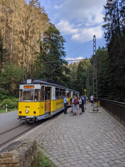
The heritage tramway, the Kirnitzschtalbahn, runs through the Kirnitzsch valley
This section of the route starts in the village of Altendorf, just north of Bad Schandau. However, the more convenient starting point (if coming from Dresden on a day trip, like we were) is to get the train to Bad Schandau and then get the Kirnitzschtalbahn to Ostauer Mühle and join the route from there. (The advantage also being a ride on the historic tramway.)
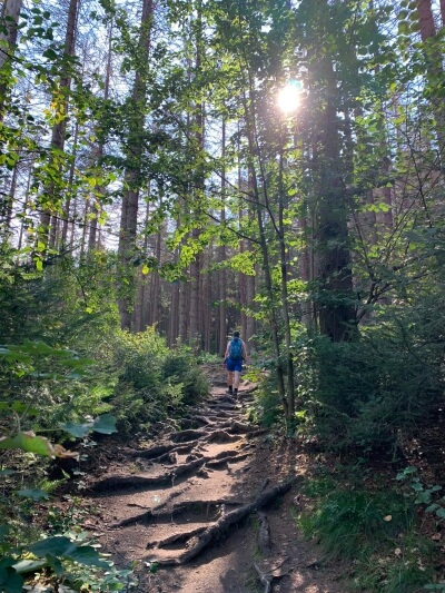
Starting the hike from Ostrauer Mühle
From Ostauer Mühle, you’ll head into the forest, following a well-worn path, which will lead you to the Schrammsteine, the first of several monolithic rock formations that you’ll come across. The path leads you between the two rock forms, which means lots of great photo opps. Make sure to follow the signs though, because we immediately lost the track at this point (for the second time) and just blindly followed a different path. After a brief, agonising steep ascent to the Breite Kluft, we re-joined the route.
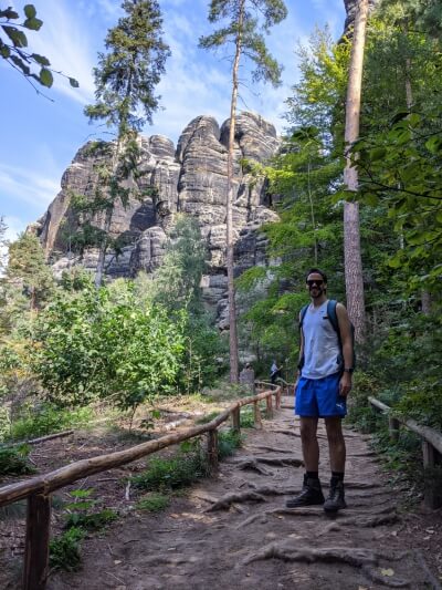
Posing in front of the Schrammsteine
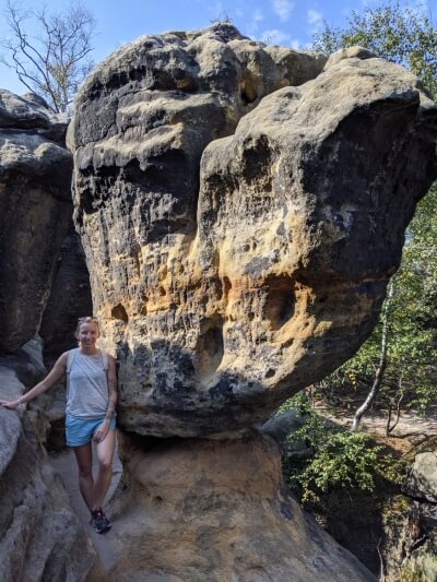
Posing at the top of the Heilige Steige
From here, the route takes you over some rocks with the help of some narrow staircases named the Heilige Steige – the holy stairs. From the top, there are some fantastic views across the countryside. On our visit, the day was clear enough to see the hills of the winding Elbe valley well into the Czech Republic.
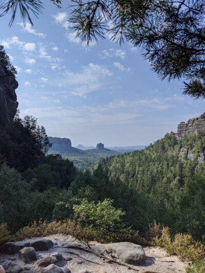
View from the Domerker
Next, you wind around to the Domerker, which is essentially just a gigantic cliff edge from where you begin your ascent back down to the valley floor, taking a few staircases on your way down. On the right you’ll be treated to a view of sheer, flat rockface, but about half-way down on the left you’ll be treated to one of the most incredible views. It really was jaw-dropping to be honest. The clear skies meant we could see for miles and thought I’m still not 100% sure which outcrop it is you can see in the middle there, it was perfectly positioned. This hike was worth it just for this photo alone tbh.
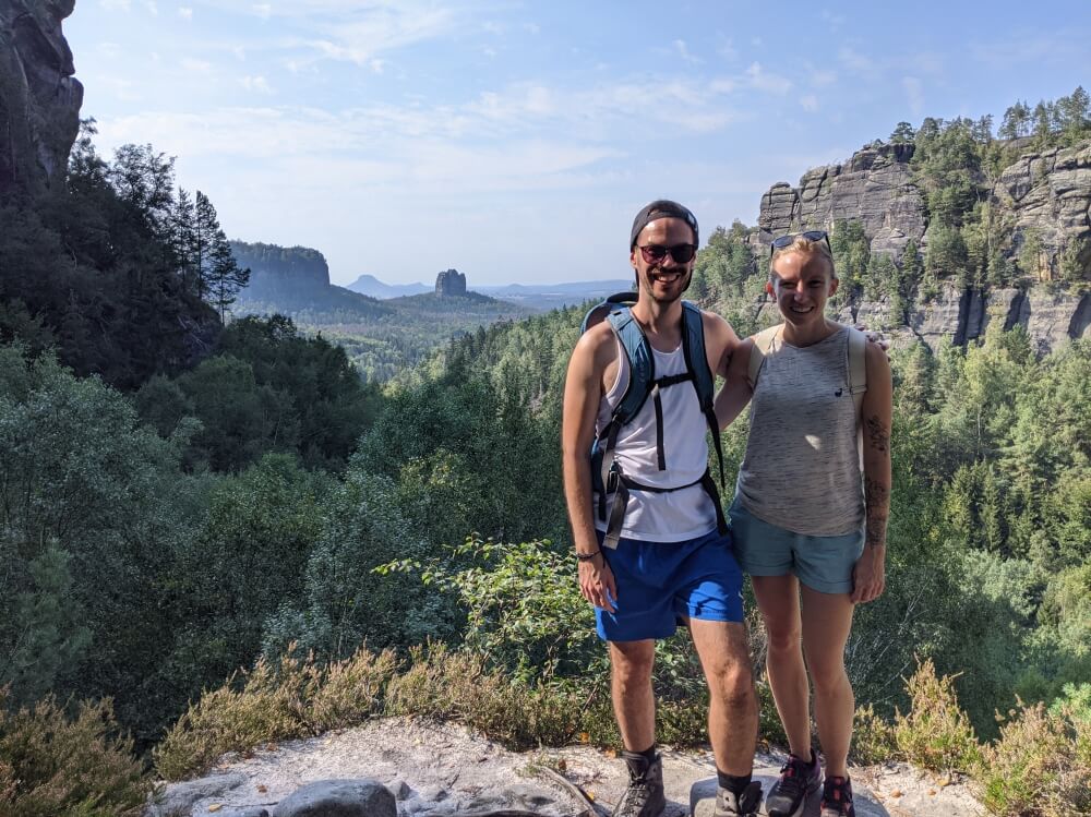
Taking a breather on the Malerweg
From here, the paths mellows out quite a lot and you’ll find yourself on forest roads again, rather than woodland paths. You’ll skirt around a few more formations, include the Bloßstock, which you’ll get a cracking view of from the path, before continuing onto the main road with the tramway again.
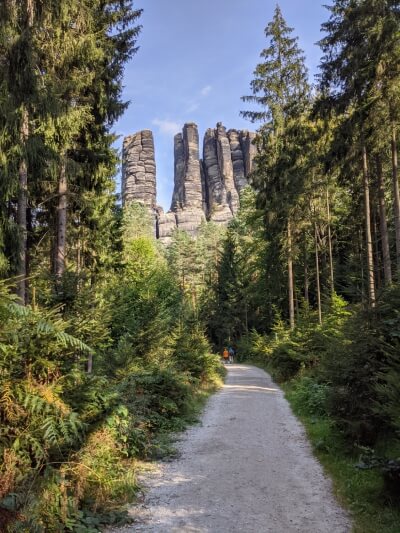
View of the Bloßstock from the path
You’ll then follow the road to the criminally overrated waterfall (we weren’t even sure if it was the waterfall…), before you begin a long climb heading for the Kuhstall. Now the Kuhstall is genuinely cool – it’s a naturally hollowed-out hole in the rock, which forms a natural platform overlooking another valley or plateau. The view is very nice by itself, but having your eyes adjust to it as you walk through the rock is pretty special.
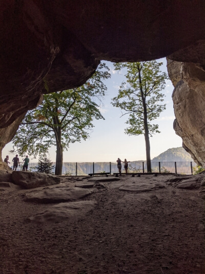
The Kuhstall
There’s also an optional ascent here – the Himmelslieter or Heaven’s Ladder, which I did not do. But Denise said it was lovely! After this, the hike ended for us at Felsenmühle, where we sipped on a Radler until our bus arrived to take us back to Bad Schandau train station.
Feeling inspired to see more of Germany? Read more here.
Cycling to Saxon Switzerland: the Elberadweg from Dresden
Aside from hiking, cycling is another popular activity in the area, no doubt helped by the Elberadweg, a maintained and signposted cycle path along both sides of the river that runs all the way from Špindlerův Mlýn (a mountainous town in Northern Czech Republic) to Cuxhaven on the North Sea coast.
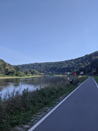
The Elberadweg, the cycle path that follows the Elbe
In September 2020, we rented bikes in Dresden (from Roll on Dresden) and took on a very short section (around 30km), cycling from Dresden city centre along the Elbe to Rathen, a spa town and home of the Bastei. We followed the southern side of the river, which allowed for the best views of Schloss Pillnitz (Pillnitz Castle) and the Basteibrücke on the opposite riverbank. This also meant we cycled in cooler shade and finished on the right side of the river in Rathen for the train station.
Coming back with the bikes by train was not a problem (the carriages had plenty of space for bikes), making it a very convenient day trip from Dresden.
How to get to Saxon Switzerland
Getting to Saxon Switzerland from Dresden is pretty easy. The S1 train follows the trainline that hugs the Elbe and stops in every town, including Pirna, Stadt Wahlen, Rathen, Königstein and Bad Schandau. This is probably the easiest (and cheapest) way to reach everything listed above, although there might be quicker connections available to Bad Schandau and Pirna. Bad Schandau is also a stop on the Berlin – Prague overnight train.
To reach Königstein Fortress, alight the train at Königstein and take the FESTUNGEXPRESS bus to the fortress car park.
Both Hohnstein and the Bastei can be reached with the 237 Wanderbus (Hikingbus) that runs at weekends from Pirna.
Would you want to visit Saxon Switzerland?
Comment below!


You got me at Caspar David Friedrich. Thanks for sharing your experience John. The landscape sounds picturesque.
It really is an incredibly beautiful place – easy to see how these painters were so inspired.
Great read and lovely photos!!
You have convinced me to look into visiting!!
Thanks Cathy! I’d definitely recommend it and Dresden as a great getaway from London!